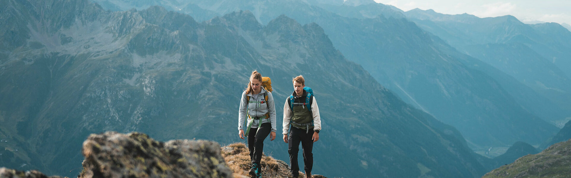
Huts & Hiking Tours
Come with us in the Tyrolean Ötztal on high tours!
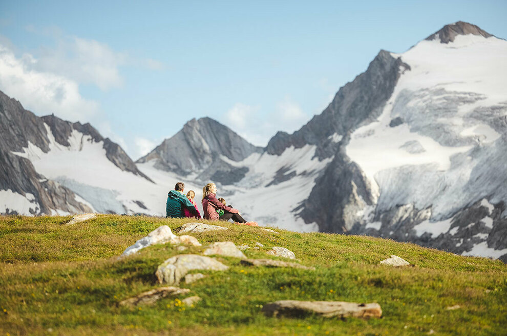
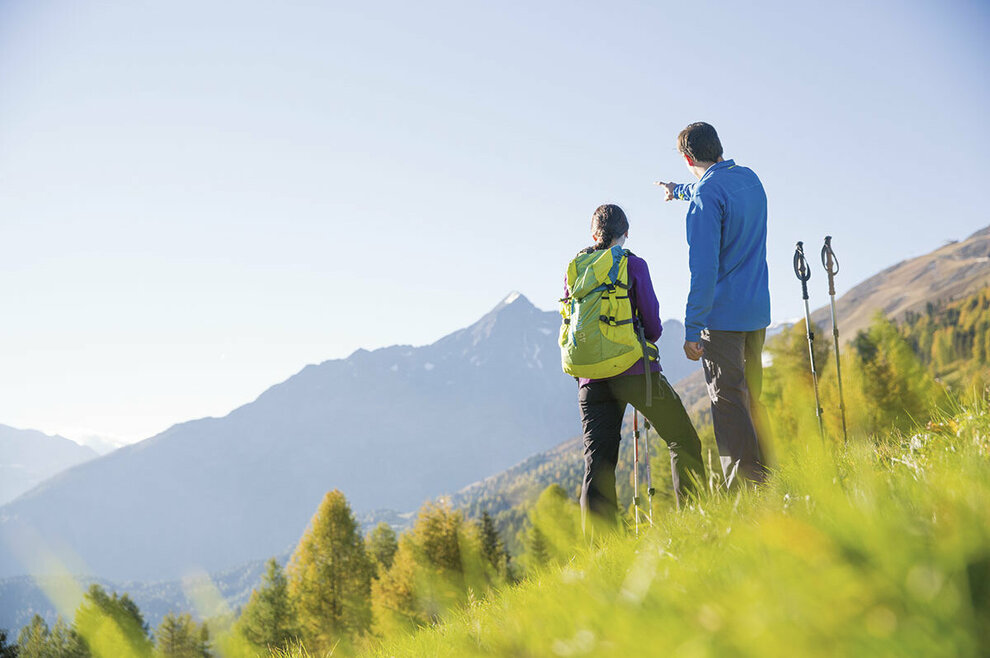
There are no limits for outdoor and nature lovers in the Tyrolean Ötztal. The alpine landscape impresses with its top winter sports areas as well as with diverse outdoor recreational opportunities in summer. The varied mountain bike tours of different levels of difficulty, for example, exert a special charm. But also mountain tours and hut hiking tours are popular summer activities due to the fascinating landscape panoramas.
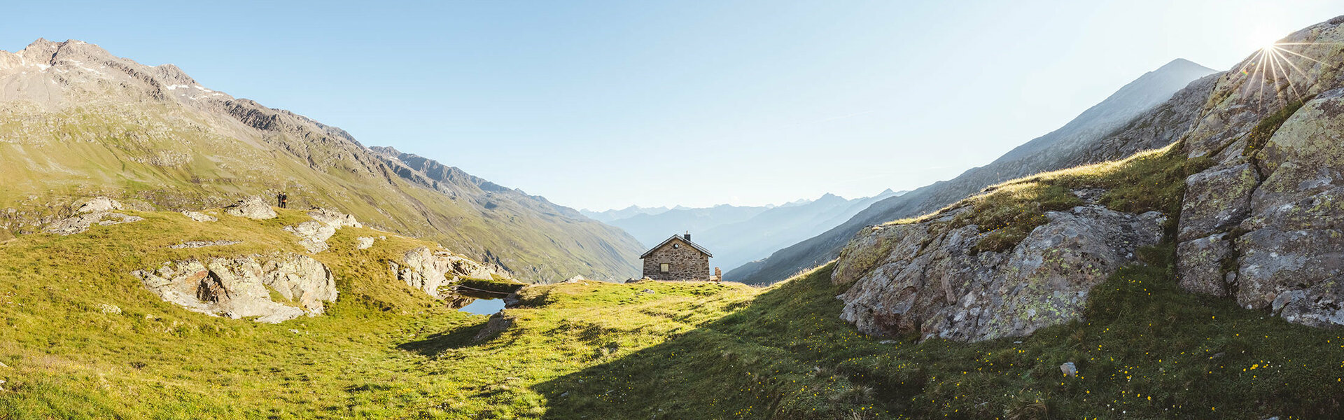
Rustic hut hiking tours
Tyrol offers its hikers a wide variety of cozy huts and refreshment stops along the various hiking tours in the Ötztal. As large as the selection of different hiking tours is, you will also find different refreshment stops. So you can - to name just a few examples - stop at the Hahlkogelhaus high up at 2,655 meters altitude, not far from the Funpark Guben, or after already 1,385 meters altitude in the snack station Brand dangle the soul and let the view sweep far over the Ötztal. A total of almost 20 huts and snacks welcome you on your hiking tours.
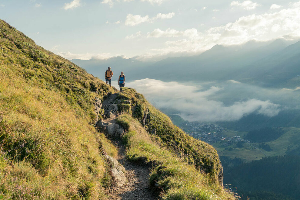
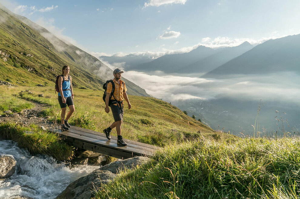
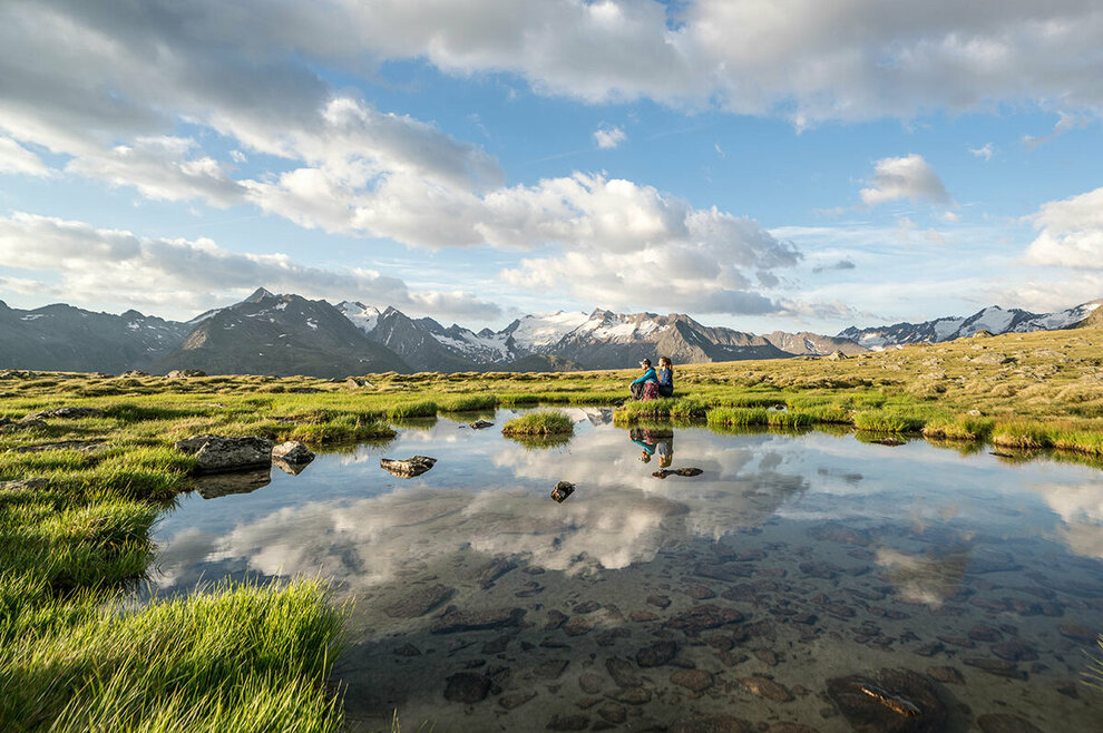
Hiking routes in the Ötztal
High altitude trail Hochgurgl - Königstal - Ferwalltal - Gaisbergtal - Obergurgl:
Starting point Hochgurgl
Walking time approx. 4 hours
Highest point 2.300 m
Good hiking trail
Refreshment stop: Nederhütte
Points of interest: panoramic view of the lake plateau and the Gurgler glacier world
From Hochgurgl past the little church into the Königstal valley. Cross the Königsbach stream, then a short climb and turn left onto the high trail to the Ferwalltal valley. Cross the bridge of the Ferwallbach and take the path branching off to the left to the Gurgler Heide. Pass the lift station of the Roßkar lift into the Gaisberg valley and then descend to Obergurgl.
Zwieselstein - Timmelstal - Timmelsjoch:
Starting point Zwieselstein
Walking time approx. 3 ½ hours
Highest point 2.474 m
Good footwear required!
Refreshment stops: Rest house Timmelsjoch
Places of interest: Timmelsjoch road.
From Zwieselstein at the foot of the Brunnenberg in Timmelstal and on a well-marked path to the Timmelsjoch.
Obergurgl - lake district:
Starting point church in Obergurgl
Walking time approx. 1 ½ hours
Highest point 2,670 m
Good hiking trail
No refreshment stop
Points of interest: view of the Gurgler glacier world, lake plateau.
From the church on first slightly sloping meadow path to the bridge over the Ache. From there steadily ascending to the lake plate.
Vent - Rofenhöfe - Vent:
Starting point Vent, post office
Walking time approx. 2 ½ hours
Highest point 2.011 m
Easy hiking trail
Refreshment stops: Rofenhof, Geierwallihof
Points of interest: particularly magnificent alpine flora along the path to the highest farms in Austria, suspension bridge.
From the post office in Vent across the Rofenbach, then left along the Rofenwand to the suspension bridge and across it to the Rofen farms. From there back on the road to Vent.
Vent - Martin-Busch hut - Similaun hut - Ötzi's discovery site:
Starting point Vent
Walking time approx. 6 ½ hours, possibly 2-day tour
highest point 3.200 m
Good condition required!
Refreshment stops: Martin Busch hut, Similaun hut
Points of interest: Ötzi discovery site, view from the Similaun hut to South Tyrol and the Dolomites.
From Vent on the left before the Rofenache over the bridge of the Niedertalbach, through the Niedertal to the Martin-Busch hut. From there on a moderately steep trail to the Niederjochferner. To the right of the Ferner to the Similaunhütte. From the Similaun hut a secured hiking trail leads along the ridge to the place where "Ötzi", the Iceman, was found.
Vent - Hochjoch-Hospiz - Brandenburger Haus:
Starting point Vent
Walking time approx. 7 hours
Highest point 3.274 m
Only for experienced mountaineers!
Refreshment stops: Rofenhöfe, Hochjoch hospice, Brandenburger Haus.
Attractions: Unique tour through the glacier world of the Ötztal Alps
From Vent to the Rofenhöfe to the Hochjochhospitz. Continue on the Deloretto trail below the Guslarspitze in hairpin bends to the Rangenburger Jöchl and over the Kesselwandferner to the Brandenburger Haus.
Sölden - Granstein - Hochwald - Aschbach - Sölden:
Starting point Sölden-Lochlehn
Walking time approx. 4 ½ hours
Highest point 1,570 m
Good hiking trail
Refreshment stops: Grüner snack station, Hochwald snack station, Aschbach inn.
Points of interest: hike through charming larch forest, view to Sölden.
From Sölden to the hamlet of Lochlehn. Then branch off to the right on a trail through the "Gehörde" to Granstein. Continue to the Hochwald snack station down to Aschbach. From Aschbach up to the hamlet of Brand. Via the forest road back to Sölden.
Hochsölden - Dr.-Bachmann - path - Bergler lake - Granstein - Sölden:
Starting point Hochsölden
Walking time approx. 4 ½ hours
Highest point 2,150 m
Moderately difficult hiking trail, partly surefootedness required!
Refreshment stops: Inns in Hochsölden, snack station Hochwald, snack station Grüner.
Attractions: Wonderful panoramic view, Bergler Lake
From Hochsölden on the well-marked Dr.-Bachmann-Weg over the Marchrinnen to the Gransteiner Bergalm. Continue to the Bergler lake and over the Hochwald to Granstein. From there back to Sölden.
Sölden - Brunnenbergalm - Falkners Gasthaus - Brunnenkogelhaus:
Starting point Sölden
Walking time approx. 4 hours
Highest point 2.738 m
Good condition and good shoes required!
Refreshment stops: Moosalm, Brunnenbergalm, Falkner's Gasthaus, Brunnenkogelhaus.
Attractions: Wonderful view into the Venter valley and to Hochsölden
From Sölden to the hamlet of Moos. From there on a forest road to the Brunnenbergalm and Falkner's Gasthaus. Continue on a steep trail to the Brunnenkogelhaus. Descent on the same path back or into the Windach valley.
Längenfeld - Nedertal - Gries:
Starting point Längenfeld, church
Walking time approx. 2 hours
Highest point 1.569 m
Good hiking trail
Refreshment stop: Unterlehnerhof
Points of interest: Along the wildly roaring and steeply sloping Fischbach stream.
Behind the parish church on the farm road through the gorge and along the Fischbach uphill to Gries.
Huben - Burgstein - Längenfeld:
Starting point Huben
Walking time approx. 2 hours
Highest point 1.400 m
Easy hiking trail
Refreshment stops: Inns in Burgstein and Längenfeld
Attractions: Beautiful panoramic view of the Längenfeld/Huben valley basin.
From Huben along the Ache river to the hamlet of Runhof. Cross the road at Runhof and follow the road to Burgstein. From there continue on the old road to Längenfeld.
Längenfeld - Unterried - Wurzbergalm:
Starting point Längenfeld-Lehn
Walking time approx. 2 hours
Highest point 2,575 m
Good, moderately steep hiking trail
Refreshment stop: Wurzbergalm
From Unterried on the forest road to the Wurzbergalm.
Gries - Nisslalm - Schönrinnkarsee:
Starting point Gries
Walking time approx. 2 ½ hours
Highest point 2.353 m
Easy hiking trail
Refreshment stop: Nisslalm
Points of interest: scenic hiking trail to Schönrinnkarsee.
From Gries along the Wirschaftsweg in the direction of the Amberger Hütte. Shortly after Vögelasbrücke, continue on the right forest road to Nisslam. From there on a slightly ascending path to Schönrinnkarsee.
Gries - Winnebachseehütte - Gänsekragen:
Starting point Gries
Walking time approx. 4 hours
Highest point 2.914 m
Good condition required
Refreshment stop: Winnebachsee hut
Points of interest: Winnebachsee, panoramic view from Gänsekragen to Gries
From Gries on the road up to Winnebach. From there on a good path somewhat steeper into the Winnebach valley and to the Winnebachseehütte. From the hut on an easy but steep path up to the summit of the Gänsekragen.
Umhausen - Lehn/Platzl - Tumpen - Umhausen:
Starting point Umhausen, church
Walking time approx. 2 ½ hours
Highest point 983 m
Beautiful hiking trail
Refreshment stops: Inns along the way
Points of interest: little church "Maria Schnee", striking angel wall, romantic tour along the Ötztaler Ache.
From the Umhauser church over the bridge and on the footpath to the little church "Maria Schnee". From there through the hamlet of Lehn/Platzl and under the Engelswand to Tumpen. Cross the road there and continue hiking to Burgstein. Continue on the forest road in the direction of Hopfgarten. Via Farchat and Neudorf back to Umhausen.
Umhausen - Stuiböbele - Stuibenfall - Gasthof Stuibenfall - Niederthai - Umhausen:
Starting point Umhausen, church
Walking time approx. 4 hours
Highest point 1.550 m
Good footwear required!
Refreshment stops: Gasthof Stuiböbele, Gasthof Stuibenfall and inns in Niederthai.
Attractions: Stuibenfall, the highest waterfall in Tyrol with a drop of over 150 meters.
From the Umhaus church on slightly ascending meadow and forest paths to the Stuiböbele snack station and on to the Stuibenfall. From there on a comfortable path to the hamlet of Höfle. Back to Niederthai and on the old road to Umhausen.
Umhausen - Farst - Reichalm:
Starting point Umhausen, church
Walking time approx. 4 ½ hours
Highest point 1,962 m
Good hiking trail
Refreshment stops: Farst snack station and Reichalm
Points of interest: Farst, the oldest settlement in the Ötztal and magnificent views of Umhausen and the Ötztal mountains.
From Umhausen over the bridge and through meadows in the direction of Engelswand. Then on a steeply ascending path up to the mountain farming village of Farst. From here across mountain meadows, later through dense forest, on to the Reichalm.
Niederthai
Niederthai - Larstighof - Gubener hut - Pforzheimer hut:
Starting point Niederthai, church
Walking time approx. 4 hours
Highest point 2.310 m
Good, moderately steep hiking trail
Refreshment stops: Larstighof, Gubener hut, Pforzheimer hut.
Points of interest: Not too strenuous tour through scenic valleys.
Following the forest road, you soon reach the Larstighof. From there, continue moderately steep to the Gubener Hut and through the Zwieselbach Valley, along the Central Alpine Trail to the Pforzheimer Hut.
Niederthai - Hemerkogel - Wiesle:
Starting point Niederthai-Lehen
Walking time approx. 4 ½ hours
Highest point 2,759 m
Good footwear required, danger of slipping in wet conditions!!!
Refreshment stop: Wiesle.
Points of interest: wonderful panorama of the surrounding mountains.
From Niederthai-Lehen gently uphill on the forest road to the Mauslassattel. In front of there, following a path, through the Hemerwald to the Hemeralm. From the Obere Hemeralm begins the moderately steep but long climb to the summit. On the return path, turn left at the Untere Hemerachalm in the direction of Wiesle.
Oetz - Sautens - Wiesenweg - Oetz:
Starting point Oetz, Piburger road to Piburg.
Walking time approx. 1 ½ hours
Highest point 812 m
Easy hiking trail
Refreshment stops: Restaurants in Sautens and Oetz.
From the lower Brandach bridge along the Piburg road to the junction and then right on the meadow path to Sautens. The way back leads over the bridge and along the right bank of the Achen to Oetz.
Oetz - Kohlstatt - Seejöchl - Piburg - Oetz:
Starting point Piburger Straße
Walking time approx. 3 ½ hours
Highest point 1,060 m
Good footwear required
Refreshment stops: Inns in Piburg
Points of interest: natural spring at Kohlstatt and view from Seejöchl to Lake Piburg.
Oetz - Klingenburg - Oetzerau - Auer Klamm -Ebene - Oetz:
Starting point Oetz, Kirchweg
Walking time approx. 4 hours
Highest point 1.016 m
Good footwear required
Refreshment stop: Oetzerau restaurants
Points of interest: View into the deep gorge of the Nederbach.
Pass the church of Oetz in the direction of Kühtaier Straße. Cross the road and continue towards Oetzerberg. Past the Klingenburg farms to the turnoff to Oetzerau. From there take the footpath to Oetzerau. Continue to the Auerklamm gorge or branch off to the left to Ebene. Back over the bridge in the direction of Sautens. Behind the bridge turn left and continue on the meadow path to Oetz.
Sautens - Rammelstein - Forchet - Oetzbruck - Löckpuit - Sautens:
Starting point Sautens, leisure center
Walking time approx. 3 ½ hours
Highest point 824 m
Easy hiking trail
No possibility to stop for refreshments.
Points of interest: Sautner Forchet, an extensive, wooded landslide area.
From the Sautens leisure center on the driving path to the hamlet of Rammelstein. From there along the Oetztaler Ache, under the main road, to Oetzbruck. From Oetzbruck to Löckpuit, crossing the federal road, to the road of Roppen and on this road to Sautens.